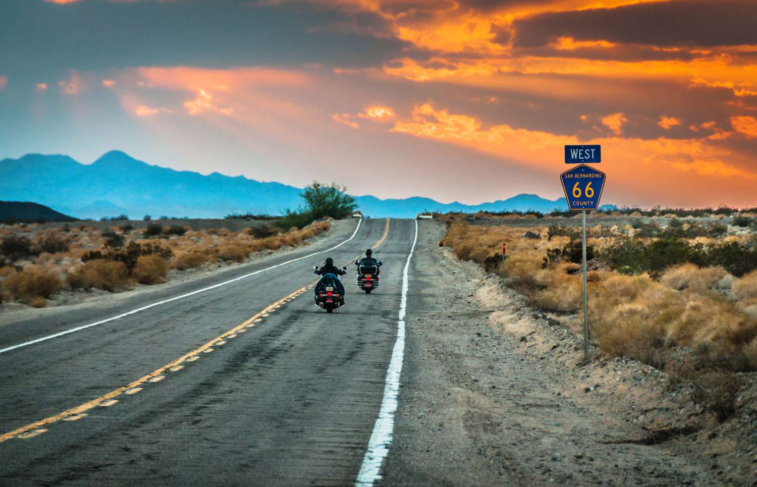
The “Mother Road” — Route 66 — is more than a highway. It’s a cultural ribbon stitched across the American heartland, full of neon, quirky roadside attractions, classic diners, and sweeping landscapes that shift from Midwestern plains to Mojave desert. Whether you’re planning the full Chicago → Santa Monica pilgrimage or a shorter slice, this guide gives you practical, research-backed, SEO-friendly planning advice and an easy-to-follow itinerary to make the trip real — and unforgettable.
Quick facts at a glance
- Historic length: ~2,448 miles original alignment (shortened/realigned over decades; many sources use 2,248–2,448 miles depending on chosen alignment). Wikipedia+1
- Endpoints: Chicago, Illinois → Santa Monica / Los Angeles, California. Wikipedia
- States crossed: Illinois, Missouri, Kansas, Oklahoma, Texas, New Mexico, Arizona, California. Wikipedia
- Best months to drive: Late spring (April–June) and early fall (September–October) for mild weather and fewer extremes; avoid high summer heat in the Southwest unless that’s your plan. Moon Travel Guides+1
Why Route 66 still matters — economics and preservation
Route 66 is a living heritage corridor. A Rutgers University–directed economic impact study for the National Park Service underscores that heritage tourism along Route 66 contributes meaningfully to local and state economies, bolstering small towns, museums, restaurants, lodging, and preservation efforts. The study highlights how maintaining historic segments and attractions helps sustain jobs and local revenue while encouraging investment in conservation. If you’d like to support these communities, plan to spend in local diners, gift shops, museums, and historic motels. National Park Service+1
How much time do you need?
Here are common options based on pace and priorities:
- Fast pace (highway & highlights): 7–10 days — you’ll see major attractions but move quickly. route66roadtrip.com
- Comfortable full drive (recommended): 2–3 weeks — time for detours, museums, hikes, and rest. route66roadtrip.com
- Regional trips: 2–5 days per state or region (e.g., Illinois/Missouri or Arizona/New Mexico slices). Great if you can’t do the whole route.
Practical note: Route 66 is not a continuous single highway like the Interstate system; much of it is made up of historic alignments, business loops, and local roads. Allow extra time for navigation, gas stops, and photo ops. Wikipedia+1
Best time to go — weather, crowds, and safety
- Spring (April–June): Top pick. Pleasant temps across most states, wildflowers in places, and lower tourist volumes than summer. Moon Travel Guides
- Summer (July–August): Warm and busy — especially in Midwestern and Southwestern segments where heat can be extreme (Arizona/New Mexico/Texas deserts). Plan early driving hours and lots of water. Driving Route 66
- Fall (September–October): Great shoulder season — cooler temps and fall foliage in the Midwest; still warm in the Southwest. Moon Travel Guides
- Winter: Parts of the route (especially the Midwest and higher elevations in Arizona/New Mexico) can be cold or snowy. Some rural businesses reduce hours off-season.
Route 66 must-see stops (state-by-state highlights — top picks)
Here’s a hand-curated list of the iconic, quirky, and locally loved stops you should consider. This list combines classic attractions with community favorites.
Illinois
- Begin in Chicago: Start with the official Route 66 Begin sign (Jackson Boulevard & Michigan Ave).
- Gemini Giant (Wilmington): The classic Muffler Man statue by the Launching Pad Drive-In.
- Pontiac Murals & Route 66 Hall of Fame: Great photo ops and local history.
Missouri
- Chain of Rocks Bridge (near St. Louis): Walkable historic bridge over the Mississippi.
- Cuba Murals: A small town with big public art.
- Meramec Caverns (Stanton): Commercial caves with kitschy Route 66 history.
Kansas
- Galena & Cars on the Route (Elijah’s Garage): Small but worth a stop, with restored historic glimpses.
Oklahoma
- Route 66 Museum (Clinton): Excellent state museum on the Mother Road.
- Pops (Arcadia): Neon soda bottle and enormous soda shop — perfect photo and snack stop. Southern Living
Texas (Panhandle)
- Cadillac Ranch (Amarillo): Buried Cadillacs painted by travelers. Bring spray paint if you want to leave a mark — it’s interactive public art. Plainview Herald
- Big Texan Steak Ranch (Amarillo): Famous for its 72-oz steak challenge.
New Mexico
- Tucumcari murals: Classic neon, motels, and mid-century signage.
- Santa Fe/Albuquerque detours: Cultural detours worth the time.
Arizona
- Painted Desert & Petrified Forest National Park (near Holbrook): Geologic wonder and colorful landscapes.
- Wigwam Motel (Holbrook & San Bernardino): Sleep in a teepee-shaped room.
- Grand Canyon detour (from Williams/Seligman): Iconic natural wonder — expect to add a day. theroute-66.com
California
- Oatman (historic mining town): Wild burros wander the main street.
- Santa Monica Pier: Official end point — snap a photo at the Route 66 End of the Trail sign.
Sample 14-day Classic Route 66 itinerary (practical, with daily targets)
| Day | Start → End (approx) | Highlights |
|---|---|---|
| 1 | Chicago → Springfield IL (200–230 mi) | Begin sign, Joliet, Pontiac murals, Abraham Lincoln sites |
| 2 | Springfield IL → St. Louis MO (100–120 mi) | Chain of Rocks Bridge, Gateway Arch (detour) |
| 3 | St. Louis → Springfield MO (215–250 mi) | Historic downtowns, local diners |
| 4 | Springfield MO → Tulsa OK (180–220 mi) | Route 66 museums, neon signs |
| 5 | Tulsa → Oklahoma City (110–140 mi) | Pops, National Cowboy & Western Heritage |
| 6 | OKC → Amarillo TX (260–300 mi) | Cadillac Ranch, Big Texan |
| 7 | Amarillo → Albuquerque NM (290–320 mi) | Llano Estacado landscapes, Tucumcari |
| 8 | Albuquerque (rest day) | Old Town, cultural sites |
| 9 | Albuquerque → Gallup / Holbrook (240–290 mi) | Petrified Forest, Wigwam Motel |
| 10 | Holbrook → Flagstaff / Williams (140–180 mi) | Meteor Crater detour, old Route charm |
| 11 | Flagstaff → Kingman AZ (200–230 mi) | Historic motels, diner stops |
| 12 | Kingman → Oatman → Needles CA (150–200 mi) | Mojave landscapes |
| 13 | Needles → Barstow → San Bernardino (200–250 mi) | Calico Ghost Town detour |
| 14 | San Bernardino → Santa Monica (120–170 mi) | Route 66 end, Santa Monica Pier |
Adjust daily mileages to your pace — add rest days for museums, hikes, or the Grand Canyon. route66roadtrip.com
Practical planning checklist & packing list
Documents & tech
- Driver’s license, vehicle registration, proof of insurance.
- Paper map of Route 66 (mobile GPS can send you on interstates — historic roads need maps).
- Portable charger, car charger, power inverter.
- Printed list of key attractions and hours (many small museums have seasonal hours).
Vehicle & safety
- Full service before departure (oil, brakes, tires, battery).
- Spare tire, jack, basic tool kit, jumper cables.
- Emergency kit: water, snacks, first aid, flashlight, reflective triangle.
- Roadside assistance membership (AAA or similar).
Personal
- Layered clothing (desert days hot, nights cool).
- Sun protection (hat, sunscreen), reusable water bottle.
- Comfortable walking shoes and camera.
Where to sleep — motel vs boutique vs camping
- Classic motels: Part of the Route 66 charm — neon, period details. Book ahead in small towns.
- Boutique hotels & B&Bs: Offer modern comfort and often historical context.
- Camping/RV: Plenty of state parks and campgrounds; check availability near major attractions.
Tip: Many Route 66 towns depend on visitor income — staying overnight locally helps preserve the road’s communities. National Park Service
Navigation & driving tips
- Slow down and enjoy: Route 66 is about experience, not speed. Many memorable finds are off the main line.
- Use route-specific maps/apps: There are dedicated Route 66 trip planners, printed maps, and GPS files (GPX) that follow historic alignments better than mainstream navigation apps. route66roadtrip.com
- Fuel up in small towns: Gas stations can be sparse in rural stretches.
- Watch for one-lane or narrow historic bridges and lower speed limits.
- Local hours vary: Many attractions operate seasonal or limited hours — check before you go.
Supporting research & heritage tourism findings
The National Park Service summary of the Rutgers economic study shows Route 66 heritage tourism’s measurable benefits to small towns and local economies. The study suggests that interpretation, preservation, and targeted marketing increase visitation and local spending. For travelers, that means your visit can have a tangible positive impact — and that planning to buy locally helps the very businesses preserving the road’s history. National Park Service+1
Academic and travel research also supports planning during moderate seasons for safety and access — a practical conclusion mirrored by travel guides like Moon and other Trip Planner sites, which recommend spring and fall for most travelers because of weather balance and business hours. Moon Travel Guides+1
Budgeting your Route 66 trip (rough estimates for 2 weeks)
- Fuel: $400–$700 (depends on vehicle MPG and detours)
- Lodging: $1,000–$2,500 (mix of motels, hotels; budget to mid-range)
- Food & snacks: $400–$800
- Attractions & museums: $100–$400 (many museums have modest fees)
- Souvenirs & local purchases: $100–$500
Tip: Small towns often have free or low-cost attractions (murals, historic signage). Allocating some budget for museums and diners supports preservation efforts. National Park Service
Photo & storytelling tips (get the best memories)
- Golden hour photos: Early morning and late afternoon light are magical for neon signs and desert vistas.
- Include people: Shots of companions or locals add scale and life to your photos.
- Document small details: Gas pumps, menu signs, motel numbers — these make great social posts.
- Respect private property: Don’t trespass for a shot. Many sites have clear signage.
FAQs — Route 66 (quick answers to common traveler questions)
Q: Can I drive Route 66 in one week?
A: You can drive the basic outline in a week if you focus on highlights and accept long daily mileage, but you’ll miss many attractions and the relaxed, nostalgic experience. Two weeks is a more comfortable minimum for a classic trip. route66roadtrip.com
Q: Is Route 66 safe to drive?
A: Generally yes. The biggest safety considerations are weather extremes (heat in the Southwest) and rural remoteness — carry water, fuel, and emergency supplies. Many towns are safe and eager for visitors. Follow normal travel precautions. Driving Route 66
Q: Where is the official start and end of Route 66?
A: The historic start is in Chicago, Illinois (Jackson Blvd/Michigan Ave area); the traditional end is the “End of the Trail” sign at Santa Monica Pier in California. However, because the road was realigned over the decades, multiple “begin” and “end” points exist for various historic alignments. Wikipedia
Q: How do I follow the historic alignment?
A: Use Route 66 maps, apps, and guidebooks created specifically for the historic road. Standard GPS units often route drivers onto faster interstate segments. Guidebooks and state Route 66 associations provide mile-by-mile directions. route66roadtrip.com
Q: Are there guided tours?
A: Yes — you can find multi-day guided motorcoach, motorcycle, or classic car tours that cover parts or the whole route. Guided options are convenient if you prefer organized logistics over self-driving. route66roadtrip.com
Q: What should I avoid doing on Route 66?
A: Don’t speed through small towns (local police enforce limits), avoid trespassing on private land for photos, and don’t assume every business is open year-round — check hours in advance.